Sunday 8 January 2006

So what other places were you thinking of? My mother asks over the grapefruit at breakfast.

-One day out to Port Deposit to look around. More Baker Carsley history

-How far is it?

-Around 55 miles.


After breakfast and checking e-mail she says that she is waiting to take her noon medication…waiting for what… then I notice. She is dressed the hand bag is on the dining room table. She is coming along.


One can never tell with this older generation. I am in my speed mode as I head out to the Beltway and up I-95. I am also in my cheap mode as I leave the interstate just before the toll and take the route 40 bridge across the Susquehanna only to find a $5.00 toll. Spoke to the toll booth worker as I saw no notice of a toll and was told that that way back was free.


The trip north was typical interstate motoring. Didn’t dare get off – passing White Marsh where the most recent murder took place yesterday, didn’t help any but on a interstate one must make time. Stopped at the Maryland House as a rest stop.


Mental note to photograph Ripkin Stadium.


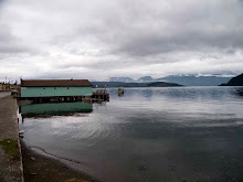
Back roads almost getting lost to Port Deposit definitely not in the Midwest as as there were curves and and hills. Pulled into town and stopped by the river to make a few snaps. A mixture of what a town that was a historic place having people who actually live there.

A modernish playground made of plastic in an area known for granite.


There were two kids throwing rocks into the river. But like most places no one else. Tried it incorporate the playground and the town. The railway and the other street furniture.


My mother remembered none of this – figures ah octogenarians it was only seventy years ago that she was here. She wanted to drive further into town to see if there was a giant granite wall that was falling down. The family lived above it.


And so it was in the middle of town there was a granite wall still being fixed with a tasteful bed and breakfast in its wake, what historic district worth its salt doesn’t have a bed and breakfast. Above the granite there were two houses. Some snaps and a wander further in the village and out the other side where I stopped to photograph a tank outside the legion hall then back into town to photograph a mill in ruins but also a truck with Jesus is the answer above the windscreen. Some formal images mixing street signage an old building and a newer one.


Was now in slow mode and since my mother’s back was fine we took the long way back route 1 crossing over the Conowingo Dam –me desperately looking for a place to stop to photograph. There was no place on the bridge and for most of the way back there were few places to pull off.


A much nicer ride, slower as the road curved so much – and I made a diversion even off Route 1. I saw a sign saying from the Atlantic to the Appalachians and I couldn’t resist. Having done this and forgetting that not being in the Midwest where all the roads are more or less the same travel times as everything was at right angle, I got lost and used the setting sun to make sure that I went west and south.


The villages passed were not all that remarkable in fact I thought that I was closer to Balamer than I was due to the contemporary tackiness of the mcmansions along the Jarrettsville Pike. Those coupled with the model railway subdivisions had me thinking that I was just outside the city rather than almost playing tag with the Mason Dixon Line.


Never the less outside the villages on the road both of us enjoyed the ride. Again it was strange how time has compressed space. I asked where my father used to like to go for frozen custard remember driving forever to this shack almost to buy some only to find out that it was at Falls Road and Greenspring Avenue miles south and west of where we are.


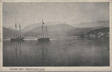
A nice day with low winter sun not great for driving as there was glare all the way back but no matter I hadn’t seen a sky this clear since Bonne Bay. Stopped at a road house where we hit the Harford Road and it couldn’t have been a better winter day – even this non winter one has here in the Mid-Atlantic states.

Wednesday 4 January 2006

So I am trying my best not to run around the city while here after all I did make the trip due to my mother being incapacitated due to her back surgery. I was doing my best to fight cabin fever.


Obligations helped at first as I had what seemed to be hundreds of letters of recommendations to write. I also brought enough stuff with me in the hopes that I wouldn’t be a good full time faculty member of the department and bring some loose ends to a conclusion. I was worried about how far behind I would become with the Brake Crocker other series that I was sending out a two to three images a week.


I also wanted to revamp my website – especially Pouch Cove as it was bit messy. All of this I thought would keep me busy. In the meantime I did go out to Sandy Point State Park – a place I remember from summer outings to the beach where I never could determine which was worse the stings of the jellyfish or trying to dodge all the dead fish that would wash up on the beach. Ah good times. A great day out which add a day to my being occupied as I made a book of wander from it.


There were frustrations – the weather here is like spring in the Midwest, 10C, but it has been raining. There was a magnificent outing bust as I drove through pouring rain that equalled the Worcester – Peasant Pissoir edge of Katrina downpour as I headed to West Virginia – on the day that the miners became trapped. It was a way of translating what I do elsewhere, here. Going to Harpers Ferry meant being in three states.


This was a “flow of consciousness” outing as I wanted to go to Antietam/Sharpsburg – what it is called is whether it is the Civil War or the War of Northern Aggression. I had this idea of a series called tripping over history – again something one doesn’t do in the Midwest. In Chicago it could be tripping over mob killings, or running from the racists, or the trail of graft but history hasn’t really caught on there.


Looking at maps.google.com to see the distance and the route – which isn’t nearly as much fun as a real map I saw that Sharpsburg is close to Harper’s Ferry and I remembered something about Harper’s Ferry when I was young so why not.


As usual I have to go back as the trip was more significant that I had imagined in my way of making things significant. Not only was I in three states but two major rivers – the Potomac and the Shenandoah. Again outside of the Mississippi/Missouri don’t remember anything that grand in the central region. The Illinois doesn’t cut it nor does the Wisconsin and forget the Rock. They are all “nice” rivers but not the same at all. Wondered about Pittsburgh with the Monongahela and the Allegany becoming the Ohio.


Didn’t do much except stop at the Tourist Board to pee due to the rain. Did stop in Virginia to make a snap of the tristate area before heading back. Missed Antietam as I turned off the National Pike too soon. Printed out the directions but left them at Menlo Drive.


Earlier I went to Columbia Maryland another paranoid Maryland utopia to Daedalus Books. I should have stock in video surveillance as again the cameras were everywhere. Notice even more red light cameras than in Harm City. They were more discrete though.


This outing only aggravated cabin fever. I tried to figure out what to do the next day – maybe pathetic playgrounds as there was one that matched that in Paterson Avenue but again driving there I couldn’t really stop it was getting dark and I ended up making a snap of the setting sun from the Safeway carpark overlooking Reisterstown Road at Milford Mill Road.


The problem with maps.google.com like the problem with the London AZ guide is one cannot connect pages. I realised that I was driving stupidly short distances but since here the city is a series of neighbourhoods walking to Mount Washington seemed far. It was two miles.


I reckoned that I would walk to the light rail take it to Woodberry so that I could go to Service Photo – and conquer my fear of Woodberry Hampden which was Klan land when I was growing up. I would then head to North Avenue as there was a homeless camp by the light rail stop that I wanted to photograph.


The walk to the Mount Washington was to see how brave I was. I was told that pulling out a camera here would get me shot but I never saw anyone on the street. I wanted to photograph peoples street furniture and finally build up the courage to do so. As I saw no one even the houses seemed empty. I also photographed things left behind where one couldn’t be sure why. I had started this in Chicago with an “Out of Sight Out of Mind” series potential.


I also wanted to photograph the different landscape that I had been seeing – more trees, more vines climbing the them, no sense of infinity.


When I first passed all of this in essence following the Jones Falls, I now saw how land is part of one’s idea of sense of place. I saw it in one direction when Frank Gohlke talked of his move east then again thinking of Monongahela Morris and her Pittsburgh ‘scapes.


The walk became a nostalgia walk, was always curious of Woodberry as I would pass through it going to Friends and was mugged in Hampden biking through it. Despite this I liked the area with the hills, the falls and the twisting streets. That changed walking through the area. Mainly Hampden as it was just typical Balamer village, better kept up than most but still nothing special.


Service Photo was closed, talked to someone who was a frustrated as I was asked if there was another shop in Baltimore. Guessed from his minutes of silence that there wasn’t one. Thought Calumet in Philadelphia and thank you web orders.


Also thought how Balamer was more like a small town than a city. The buses only run every half hour, this may be fine but I’ll find that this will make me think twice about photographing in some areas as I won’t be able to hop off a bus make a snap then hop on again. While walking Falls Road not a 27 bus hon.


Wandered back through Hampden to catch the light rail. Felt better about the area as I saw Kerry bumper stickers but then again this is a democratic state. The gay pride flag was more of a welcoming feeling. Photographed some basketball hoops, walked an alley and photographed a neighbourhood bar. As I said however the walk became a stream of consciousness walk as a playground would have me divert my walk a bit. Before I knew it I was looking for Gomez Gallery somewhere in Clipper Mill Avenue. That led me to a church with a hoop, a nice bit of decoration on factories then television hill. Prefer Woodberry to Hampden.


The light rail to North Avenue to photograph what looked like a homeless encampment – don’t know how that turned out as it wasn’t as neat as I thought it would be. Decided not to go down town and instead to take the 13 bus to Pennsylvania and North Avenue (abnew). IT was here that I went to the movies the Met, this is where my library was, Nana’s house was just around the corner. Then the new version of the 7 bus which was also the 5 bus the M-something or other up passed the house I grew up in Mondawmin Mall and then Park Heights Avenue.


Finally there were people on the streets. North Avenue was awash with people. North and Pennsylvania was bustling. North Avenue seemed the same, the old neighbourhood looked the way it did when I lived there. It ended there Park Heights Avenue made me angry here was an area not a mile from Hampden with the same type of housing that looked like a third world country. Boarded buildings, trashed housed admittedly it wasn’t the same as Park Heights is a commercial street. There was no unifying factor.


I decided to use the bus as I see more on the bus even though they are frustrating - Greyhounds run more frequently – I get to see the neighbourhoods in relative safety – drive by shootings come to mind when I think of Balamer where THE WIRE is filmed.


So I began to realise that this time was to be a coming to terms time with Balamer but in the basement when I was putting together some books I came across pictures of the Bakers and the Carsleys – and the Hawkins, I saw my grandfather’s tyre shop in Caroline Street, his birth place outside Pocomoke City. I also had bee trying to remember where Nana was buried, I knew it was off the Beltway and I-95 in Arbutus so back to maps.google.com knowing the the 51 bus is a ride through the Clarks and Davis part of the family to the 31/35 that I knew as the 3. A triangular outing was planned.